
From William Roy’s The Great Map: the military map of Scotland 1747-55
You can view the area surrounding Heiton using historic maps by accessing the National Library of Scotland’s map viewer. As well as being able to select a range of maps to view, you can ‘overlay’ a current map onto the historic map to help fix any location that you are looking at. Thanks to the National Library and to the National Library of Scotland for permission to use these images.

Hightoun as a few cottages on the road into Kelso in the second half of the 18th Century.
Reprinted with permission. © British Library Board (shelfmark 236.b.72).
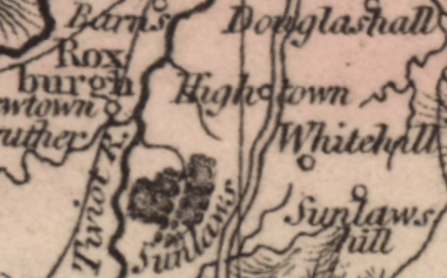
From William Roy’s The Great Map: the military map of Scotland 1747-55
More formally known as Hightown in the first part of the 19th Century. The map is from Aaron Arrowsmith, 1807.
Reproduced with the permission of the National Library of Scotland under a Creative Commons Attribution (CC-BY) licence. See also the NLS Maps website.

Now called Heiton, this image (and the image below) is from the OS six inch map of 1882. The village now has a post office, a school and an inn.
Reproduced with the permission of the National Library of Scotland under a Creative Commons Attribution (CC-BY) licence. See also the NLS Maps website.
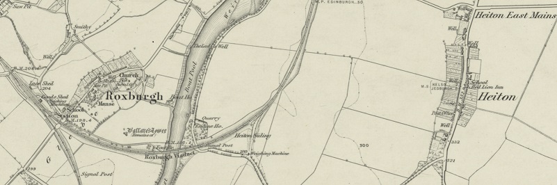
The image above shows that Heiton had acquired a railway sidings. Farm produce and animals would be taken across the river to Roxburgh.
Moving on to the OS six inch map of 1913, the Post Office appears to have moved.
Reproduced with the permission of the National Library of Scotland under a Creative Commons Attribution (CC-BY) licence. See also the NLS Maps website.
